


To reach the base of the hill, from the city of Mendoza, one must take the same path that leads to Chile, which is not infrequently found to do, travel scales, an additional attraction: the landscapes of Potrerillos, Uspallata or Puente del Inca, make us forget that we have traveled almost 180 kilometers when we got to Las Cuevas.
The trail head is the Parque Povincial Aconcagua—created in 1983—it offers 71 thousand hectares of natural splendor. There it is possible to practice all sorts of activities like family minitrekking in the Laguna and Valle de Horcones or the ice waterfall, above different glaciers.
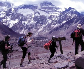
The subyugante countryside offers two lakes that lie in the valley, with its vegetation and aquatic fauna, as well as the presence of condors and guanacos (and, occasionally, a puma), en the banks of the river Horcones or at the foot of Mount Tolosa and its eastern neighbor, the Almacenes, make the ideal place for photography safaris or just to take in the scenery.
Permits and Seasons. The process to obtain the entrance permission to the Parque Provincial Aconcagua shall be done personally in the CUBA building, located at Los Robles Av. and Rosedal’s round about, Parque General San Martin, city of Mendoza, from Mondays to Fridays from 8 am till 6 pm and Saturdays, Sundays and holydays from 9 am till 1 pm. The price varies according to the length of the activity (short trek: 3 days; long trek: 7 days; ascent: 21 days) and the entrance date (permissions and identifications are an essential requirements for the stay in the park.) On the other hand, in the winter (from the 16th of March to the 14th of November), it is necessary to complete the formality of getting a demarcation of responsibilities (declaring that you enter at your own risk), given that—in this period—the Park does not offer safety services like it does in the official season (medical services, Park Rangers at “Base Camp” and rescue teams).
Once you are allowed to stay (permits and identification are a required to stay in the Park), you will have to take a long road to get to one of the “Base Camps”. These camp sites are designated for the mountaineering groups that are waiting for favorable weather to begin the ascent up Aconcagua. They are: Plaza Francia, Plaza de Mulas y Plaza Argentina.
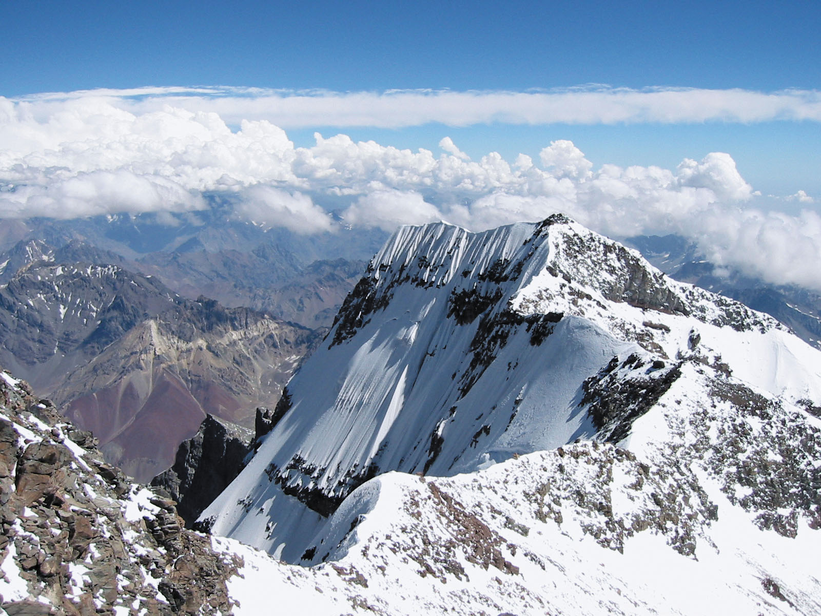
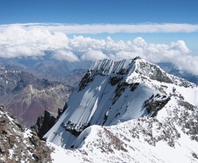
Each season (15 Nov – 15 March), it attracts thousands of climbers with its peaks and perennial glaciers such as Horcones Inferior beginning in the well-know Southern Face; Los Polacos, and Horcones Superior.
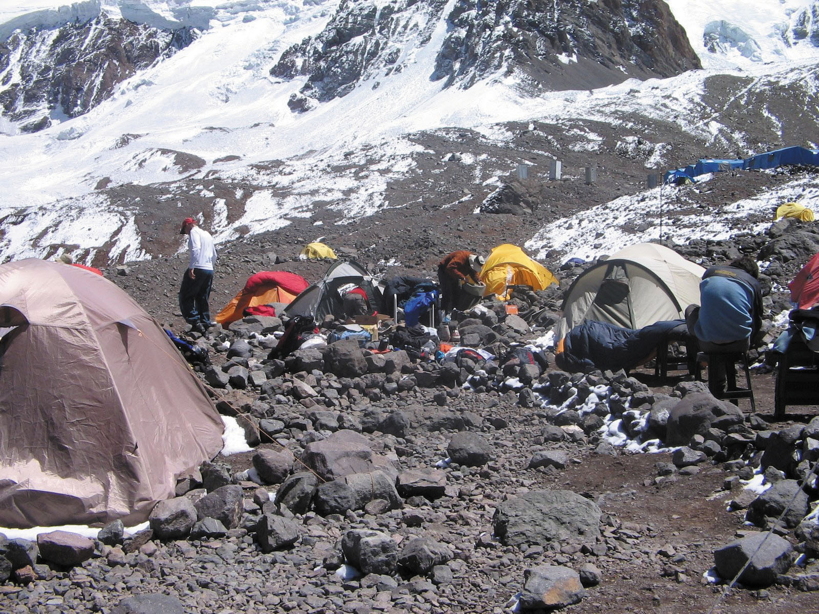
Those who are planning to climb Aconcagua may camp at any of the many camping sites in the park. Campamentos de Aproximación are used by climbers and trekkers. There are three camping sites at Quebrada de los Horcones: Quebrada del Durazno (3,000 m), Confluencia (3,500 m), and Refugio Ibañez (3,800 m); and two camping sites at Quebrada del Río Vacas: Pampa de Leñas (2,850 m), and Casa de Piedra (3,200 a.s.l.).
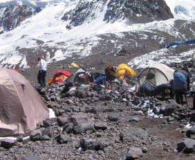
Confluencia is turned into a small village from December to March housing more than 200 tents and featuring amenities such as restaurants, night clubs, and emergency rooms. Climbers camp there before proceeding toward Plaza de Mulas where warming is more strict.
Base Camps are used by climbers who need to warm up before attempting to reach the summit of Aconcagua. These camps are Plaza Francia (4,250 m) and Plaza de Mulas (4,300 m) that features and heliport.
The latter includes the world’s highest hotel. It features 80 beds and receives daily supply transported on a mule.
High camps are used while mountaineers are climbing Aconcagua and offer protection and streams for water supply.
The following camping sites are found along the Northwestern road: Cambio de Pendiente (5,200 m), Plaza Canadá (4,910 m a.s.l.), Nido de Cóndores (5,380 m), Berlín (5,780 m), Piedras Blancas (6,030 m), and Independencia (6,400 m).
Campo I (4,900 m) and Campo II (5,800 m) camping sites are found on Glaciar de los Polacos road.
PLAZA FRANCIA
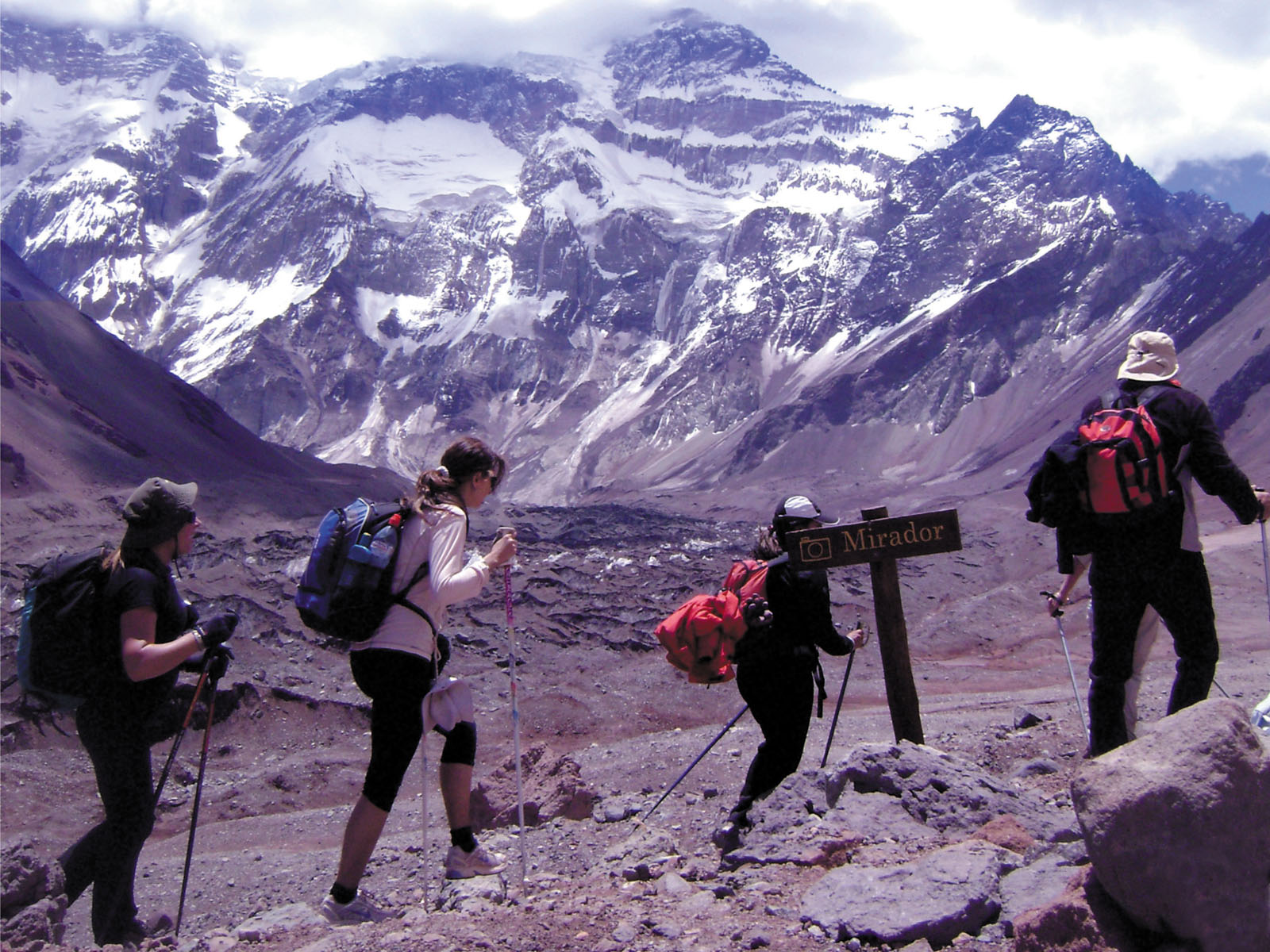
Plaza Francia It is the shortest route: only 25 km from Puente del Inca, with an altitude of 4,100 meters above sea level. Lower Glacier Horcones is found on the left side. There one can find various places apt for camping, eddies in little streams, and it is the base for the “Almacenes” climbs(4,800 meters) and “Mirador” (5,800 meters). It is a place without vegetation and the wind, in general, doesn’t create any problems.
Trekking to Plaza Francia (15 November and 15 April).
This tour may take 3-6 days. Trekking to Plaza Francia is an excellent choice for those who will not attempt to reach the summit but would like to take up the challenge, and get close to the Colossus of the Americas for the first time.
Plaza Francia is a camping site located on the base of the most difficult slope for climbing Aconcagua: the Southern Face, a 3,000 m ice and rock wall coexisting in harmonious balance. This is the best view point to get the most impressive views of the highest mountain in the Andes.
PLAZA DE MULAS
35 km Puente del Inca, it is the idea place to acclimatize, surrounded by huge boulders that protect tents and imposing mountains more than 5,000 meters high. From there, it is possible to climb the neighboring mountains (all together with heights greater 5,000 meters). Also it is possible to practice climbing glacier “Horcones Superior”. Other nearby mountains are “Cuerno” (5,450 meters) and Mount Bonete (5,100 meters). There is a small wooden refuge, for 6 to 8 people. Called “Refugio Sección Exploredores Baquenos”. It is a little too small to sleep in, but it works well as a kitchen-diningroom. Also the Hotel Refugio “Plaza de Mulas”, with rooms for four, bunk beds and a shared coed bathroom.
PLAZA ARGENTINA
About 62 km from Punta de Vacas. Despite its aptness as a campsite, because of its wide open landscape, it has stronger winds than the other spots. There is water and firewood, and the cliff and path are well marked. It is recommended that the trip be done in three parts (the exceptions being Plaza de Mulas or Plaza Francia, which only require two phases).
There are four options for climbing expeditions:
• Regular route or North-eastern (NW) that may take 10-15 days and includes trekking to several sites in the mount and warm up at Plaza de Mulas camping site. This route does not have any technical difficulties, but it is important to bear in mind that there can be heavy snow storms and the “altitude sickness” factor should also be taken into account; so, strict safety rules in mountains have to be observed and respected.
In every case, the use of tents is necessary, as all shelters are small and have capacity only for three or four people.
• Los Polacos Route (Polish Glacier Route/Eastern Face ice) This route starts at Plaza Argentina Base camp and ascends in West / North-east direction, entering through Valle del Río Vacas.
• South Wall Route or French Route (named after the nationality of the first mountaineers to climb it) 3,000 m-face of vertical ice and rock. The Glacier and the South Wall routes are considered high-risk and one of the ten big walls in the world. In this route there are not permanent regular camps and, therefore, there are some places to spend the night which are not exposed to avalanches and landslides.
This route is where the most attractive and frequented trekking takes place, lasting 3 (three) days and 2 (two) nights, sleeping at Confluencia camp at 3200 meters above sea level, and reaching the Aconcagua South Wall at 4200 meters above sea level.
• Western Face Route. Namely: Ibañez-Grajales-Marmillot (these are the surnames of the first climbers of this side heading to Chile) It’s a route with a high degree of difficulty.
Esta entrada también está disponible en: Spanish Portuguese (Brazil)
¿Qué te pareció la publicación?